Lakes of Otter Tail County
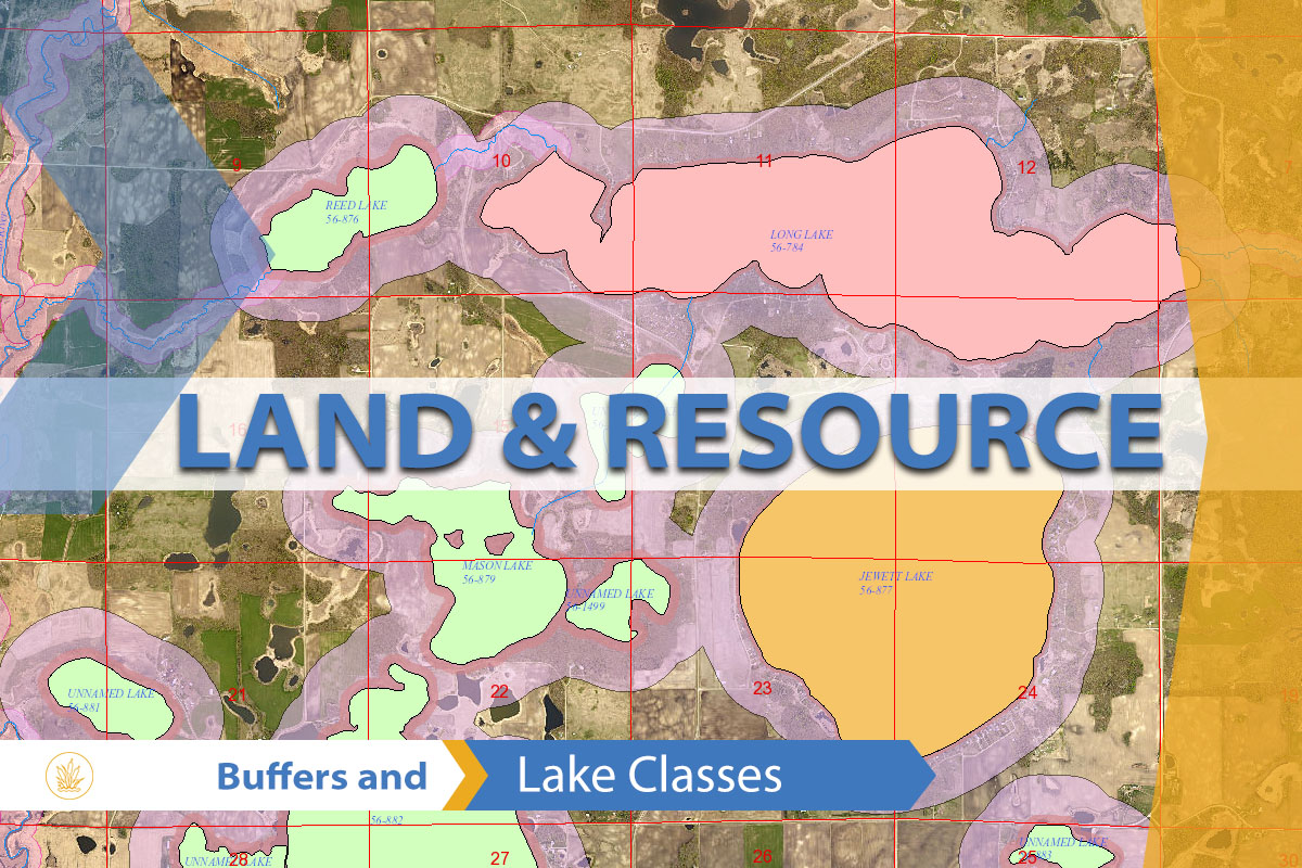
This interactive lakes map was created to assist our Land and Resource department in the management of our extensive lake system, included is the Department of Natural Resources identifier, water acres, perimeter length, and classification.
Instead of the common blue, the lakes and rivers are colored based on their representative use class, which represents what kind of development and specific land use rules are in effect with respect to that particular body of water.
The map also includes an exaggerated shaded relief map called “Terrain.” The background colors are a color representation of elevation, as used in the national geographic atlas series maps (i.e. blue indicating low elevation and red to white indicating high elevation). Otter Tail County exhibits a uniquely complex range of topographic features visible within its boundaries. This scheme allows for easy classification and identification of the various landforms visible here.
Lake List
Waters of Otter Tail County – Lake List with Classifications